.
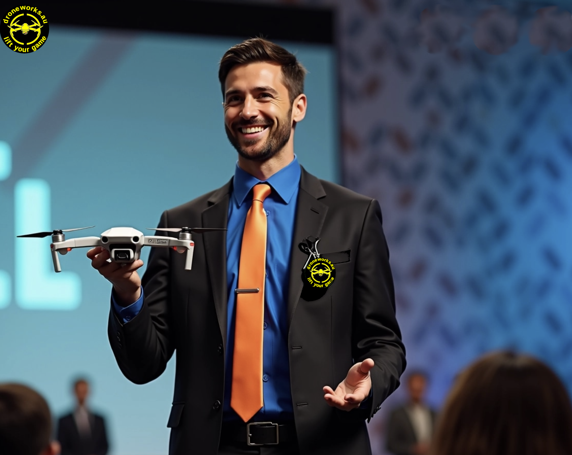
Welcome to Droneworks.au ... your AUSTRALIAN Drone Services provider:
Security and Surveillance: Let us put your aerial security plan into place together. We can monitor large crowds and events, as well as to provide security for sensitive areas such as prisons, airports and military bases.
Aerial Photography and Videography: Your stunning video footage and professional shots are ready to be captured with our high-quality cameras for any events, ie real estate, weddings, parties, sports, anywhere you need an aerial view.
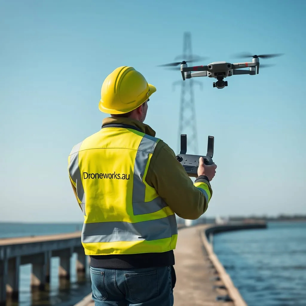
Infrastructure Inspections: Your structure inspections for maintenance, including buildings, roofs, communication towers, bridges and security fencing awaits.
Mapping and Surveying: Your detailed maps and 3D models of terrain and structures are ready.
Eco-Conservation: Monitor wildlife populations and habitats, deter poachers with our drones.
Rescue Services: Call us for your search for missing persons or to help locate victims of natural disasters or other emergencies.
Value-add features:
Secure data storage (backups, reporting and auditing)
Video editing/photo enhancement available
Director's live feed (viewing and camera control)
Our parent company is ACUSOS PTY LTD.
.
.
.
.
.
.
.
.
.
.
.
.
.
.
.
.
.
.
.
.
In Love With Drones ♥
Since 2018, we have been involved in the field of drone operations, starting out with mapping rural properties. It has been an exciting journey, and we have learned a lot along the way. Using drones for mapping has allowed our clients to collect accurate and detailed data that would have been difficult to obtain through traditional methods. It has also helped our clients to identify potential problem areas and make informed decisions about land use and management. Over the years, we have expanded our skill set to include other applications such as security, aerial photography and videography, inspections and surveys. We have our people registered as volunteers for the organisations below.
Our accreditations:
CASA - Sub 25KG Remote Pilot’s Licence (RePL)
CASA - Aeronautical Radio Operator Certificate AROC
CASA - Remote Operators Certificate CASA.ReOC.8498
CASA - Beyond Visual Line of Sight Certificate BVLOS
Our parent company is ACUSOS PTY LTD
PO Box 6212 Silverwater NSW 2128
Mob: 0450116202
Email: pilots@droneworks.au
ABN: 33 652 920 691
.


.
.
.
.
Droneworks Services to NSW Government Link
1. Public Safety & Law Enforcement
- Surveillance & Monitoring – Perimeter security and surveillance.
- Search & Rescue – Thermal-equipped drones locate missing persons.
- Disaster Response – Damage assessment after natural disasters.
- Traffic Management – Monitoring congestion and accidents.
2. Infrastructure, Housing & Urban Planning
- Auditing, Valuations and property inspections.
- Mapping & Surveying – Creating 3D city maps and parks.
- Bridge & Road Inspections – Assessing hard-to-reach structures.
- Construction Monitoring – Tracking progress and detecting issues.
3. Environmental Monitoring
- Wildlife Conservation – Tracking animal populations and poaching.
- Pollution Monitoring – Detecting air and water contamination.
- Forest Management – Identifying illegal access and fires.
4. Agriculture & Land Management
- Crop Monitoring – Assessing crop health.
- Land Use & Zoning Enforcement – Ensuring regulatory compliance.
.
.
.
.
.
.
.
.
.
.
.
.
.
.
.
.
.
.
.
.
Let us organise your next Aerial Security plan
Current Security Systems: Integration of AI-powered sensors, cameras, and analytics for real-time monitoring. Detection and response to unauthorized access and unusual activity.
Back-to-base monitoring: CASA-mandated base monitoring with Remote Pilot at the controls full time when needed.
Drone Patrolling Waypoints: Pre-programmed drones patrol designated areas autonomously. High-resolution cameras and sensors for detailed surveillance and rapid threat response.
Spotlights: Automated activation of spotlights upon detecting intruders. Illumination of specific areas to deter unauthorized access and aid in identification.
Loudspeaker Alerts: Automated or live communication through loudspeakers to issue warnings. Enhances deterrence and allows immediate response with pre-recorded or real-time instructions.
.
.
.
.
.
.
.
.
.
.
.
.
.
.
.
.
.
.
.
.
Let us organise your next Aerial Photography Session
Capturing Perspectives: Aerial photography and videography provide unique, high-angle views that are impossible to achieve from the ground, making them ideal for any events like real estate, weddings, parties, tourism, landscapes and cinematic shots.
Technology & Equipment: Modern aerial imaging relies on drones equipped with high-resolution cameras, gimbals for stabilization, and advanced flight controls, while traditional methods include helicopters and airplanes.
Applications & Uses: Used in industries such as construction, weddings, tourism, real estate, construction, agriculture, and environmental monitoring to capture detailed imagery for analysis, marketing, and storytelling.
.
.
.
.
.
.
.
.
.
.
.
.
.
.
.
.
.
.
.
.
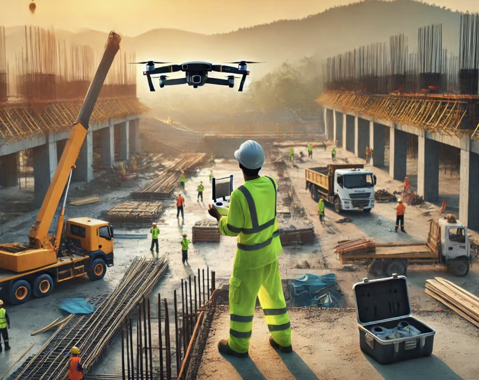
Let us get those Infrastructure Inspections completed
Efficiency & Cost Savings: Drones reduce the time and cost of infrastructure inspections by eliminating the need for scaffolding, cranes, or manual climbing, allowing for quick and thorough assessments.
Safety & Risk Reduction: By inspecting hard-to-reach or hazardous areas (e.g., bridges, power lines, wind turbines), drones minimize human exposure to dangerous conditions, improving worker safety.
High-Quality Data Collection: Equipped with high-resolution cameras, thermal imaging, LiDAR, and other sensors, drones provide detailed visuals and analytics for detecting cracks, corrosion, and structural weaknesses.
Automation & Real-Time Monitoring: Drones can follow pre-programmed flight paths and provide live feeds, enabling real-time decision-making and integration with AI-driven analysis for predictive maintenance.
.
.
.
.
.
.
.
.
.
.
.
.
.
.
.
.
.
.
.
.

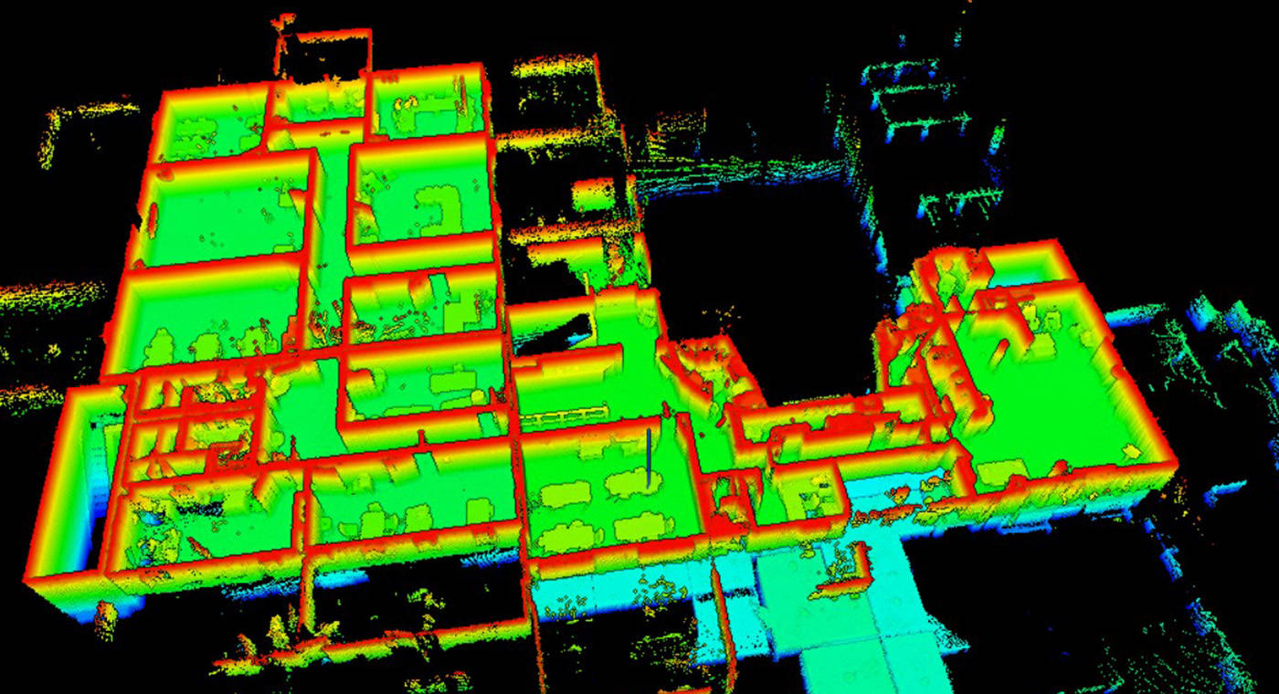
Get the right mapping and survey complete
High-Precision Data Collection: Drones equipped with GPS, LiDAR, and high-resolution cameras capture accurate geospatial data, creating detailed 2D maps and 3D models of landscapes, construction sites, and infrastructure.
Efficiency & Cost-Effectiveness: Drone mapping significantly reduces the time and cost of traditional surveying methods, covering large areas quickly with minimal manpower and equipment.
Versatile Applications: Used in industries such as construction, agriculture, mining, urban planning, and environmental monitoring for tasks like topographic mapping, volumetric analysis, and land assessment.
Automated & Repeatable Surveys: Pre-programmed flight paths allow for consistent, repeatable data collection over time, enabling progress tracking, change detection, and long-term project monitoring.
.
.
.
.
.
.
.
.
.
.
.
.
.
.
.
.
.
.
.
.
Find that lost person .. or puppy
Drones are a game-changer for rescue services because they offer speed, safety, and enhanced situational awareness. Here are three key reasons why they are so important:
Rapid Deployment & Search Efficiency: Drones can quickly cover large or difficult terrains, like mountains, forests, or disaster zones, helping locate missing persons or assess damage much faster than ground teams.
Enhanced Safety for Rescuers: Instead of putting human rescuers at risk in hazardous environments (such as collapsed buildings, floods, or wildfires), drones can be sent in first to gather critical information and even deliver emergency supplies.
Real-Time Aerial Surveillance & Data Collection: Drones provide high-resolution live video feeds, thermal imaging, and mapping capabilities, giving rescue teams crucial insights to make informed decisions and coordinate their efforts more effectively.
.
.
.
.
.
.
.
.
.
.
.
.
.
.
.
.
.
.
.
.
Make a difference with wildlife monitoring
Enhanced Conservation Efforts: Drones provide real-time data on wildlife populations, helping researchers track endangered species and protect their habitats more effectively.
Non-Intrusive Monitoring: Unlike traditional methods, drones allow for wildlife observation from a distance, minimizing stress and disruption to animals in their natural environments.
Rapid Data Collection: Drones can quickly cover vast and hard-to-reach areas, providing high-resolution images and thermal data for accurate population assessments and behavior studies.
.
.
.
.
.
.
.
.
.
.
.
.
.
.
.
.
.
.
.
.
Drone Domains For Sale
Web domains are crucial for businesses because they serve as a company's digital identity, enhancing brand recognition, credibility, and accessibility. A strong, memorable domain name makes it easier for customers to find and trust a business online, while also improving search engine rankings and marketing effectiveness. Domains provide a professional image, help establish brand authority, and protect against cyber threats like impersonation or brand dilution. Additionally, a well-chosen domain supports long-term business growth by allowing scalability, ensuring consistency across digital platforms, and serving as a valuable digital asset that can appreciate over time.
Domain names available ...
Click the chat button for more details 😉 or contact us at pilots@droneworks.au
Welcome to Droneworks.au ...
Why Choose DroneWorks.au for Aerial Imaging? ...
Our Drone Services ...
https://www.linkedin.com/in/drone-works-195999300
https://www.facebook.com/DroneworksPilot
https://x.com/Droneworks_au
Drone photography Australia
Drone videography services
Aerial mapping and surveying
Commercial drone operators
Professional drone services
Best drone photography company in Australia
Drone real estate photography near me
drone domain names for sale
Licensed drone operators in Sydney
Drone inspection services for construction
Aerial cinematography for events
Weddings events parties