
📅 April 2026: “Seeing the Whole Picture”
When it comes to buying property—especially rural or acreage listings—photos from the ground only tell half the story. This month, we focused on capturing full aerial perspectives full aerial perspectives that reveal how a property functions as a whole. From driveway access and outbuildings to water tanks, solar placement, and surrounding land use, the difference between guessing and knowing is literally a matter of altitude.
The image above is a perfect example: from ground level, you might see a house and a shed—but from the air, you immediately understand layout, spacing, infrastructure, vegetation, and usability. Buyers can assess things like proximity between structures, land condition, and even future potential without ever stepping foot on-site.
Q: Why is aerial imagery so important when viewing a property for sale?
A: Because it removes guesswork. Aerial views provide context—showing boundaries, terrain, access points, and how everything connects. It helps buyers make faster, more informed decisions and avoids surprises later.
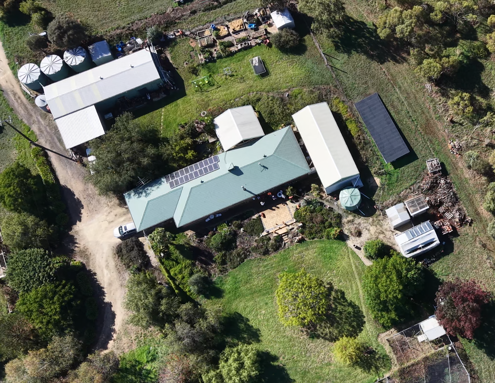
What you can’t see from the driveway can change everything.