📅 January 2026: “Victorian Bushfires — Eyes in the Sky”
Looking ahead to the 2026 Victorian bushfire season, drones will once again be an indispensable part of volunteer and emergency operations. Building on lessons from Taree, we plan to leverage aerial platforms for early detection, fire perimeter mapping, hotspot monitoring, and post-fire damage assessment.
Beyond firefighting, drones will help communities understand the scale of risk, enabling proactive evacuations and more informed resource allocation. High-resolution imagery, thermal mapping, and real-time feeds can complement official fire monitoring systems, creating a safer environment for responders and residents alike.
Bushfire deployment carries its own challenges: intense heat, smoke, dynamic firefronts, and restricted airspace require precision flight planning and coordination with authorities. When these operational limits are observed, drones provide a critical aerial perspective— improving fire management and enhancing community preparedness without adding danger to those on the ground.
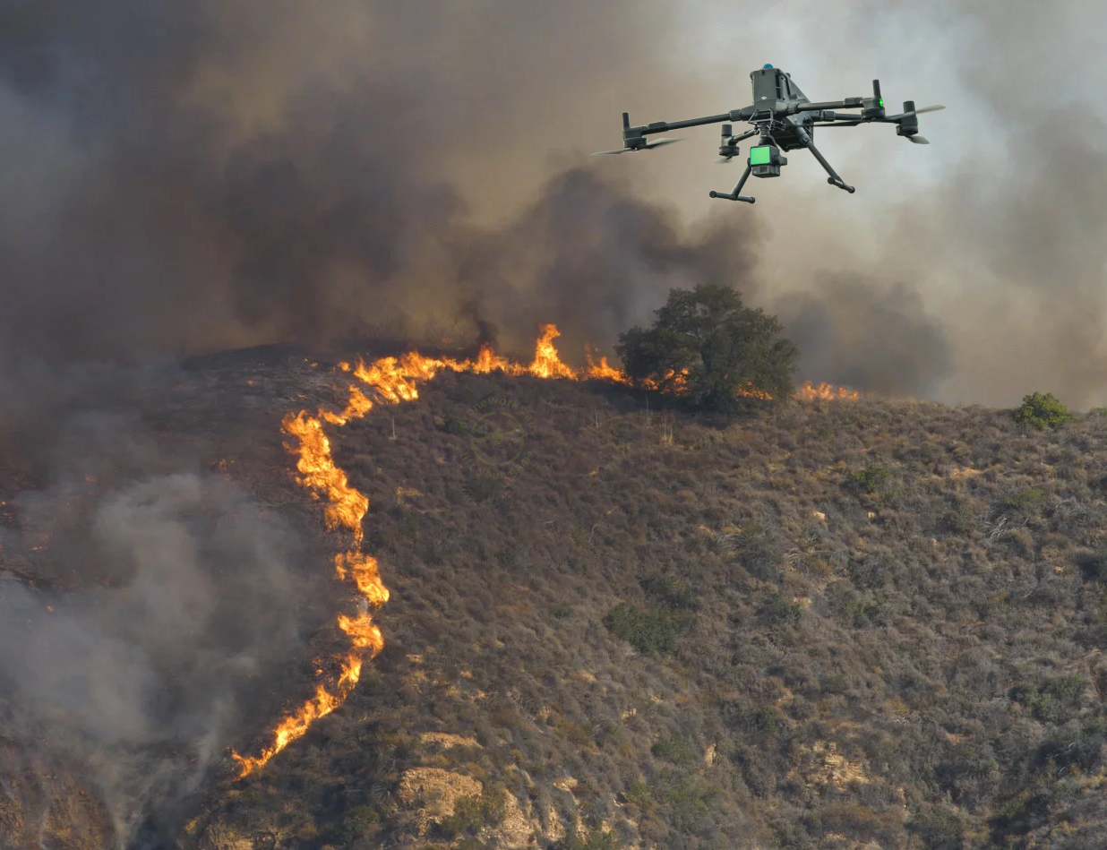
Anticipating drone operations for monitoring and assisting in Victorian bushfires.