A construction site takes form
A simple site video
Construction progress
Drone mapping is vital for construction sites as it provides accurate, real-time visuals of the area. It helps track progress, spot issues early, and improves safety by reducing the need for manual site checks. Fast and efficient, drone surveys save time and support better decision-making.
The Starting Point
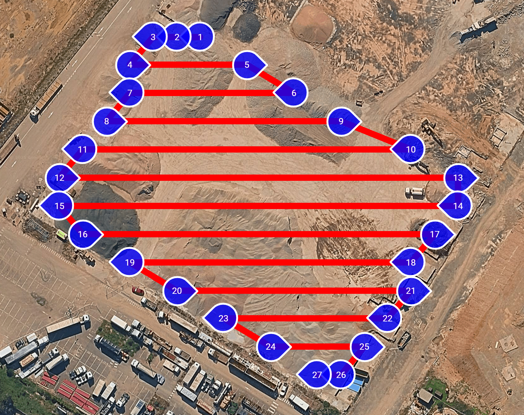
During mapping operations, drones follow a pre-planned flight path—usually a grid or lawnmower pattern—capturing overlapping images at consistent intervals. Flying autonomously at a set altitude and speed, they take photos straight down to ensure accuracy. The overlapping images are later stitched together to create detailed 2D maps or 3D models, helping teams analyze site conditions, track progress, and make informed decisions.
Before & After Comparison
Drag the slider to see the dramatic transformation of the construction site
Site Transformation
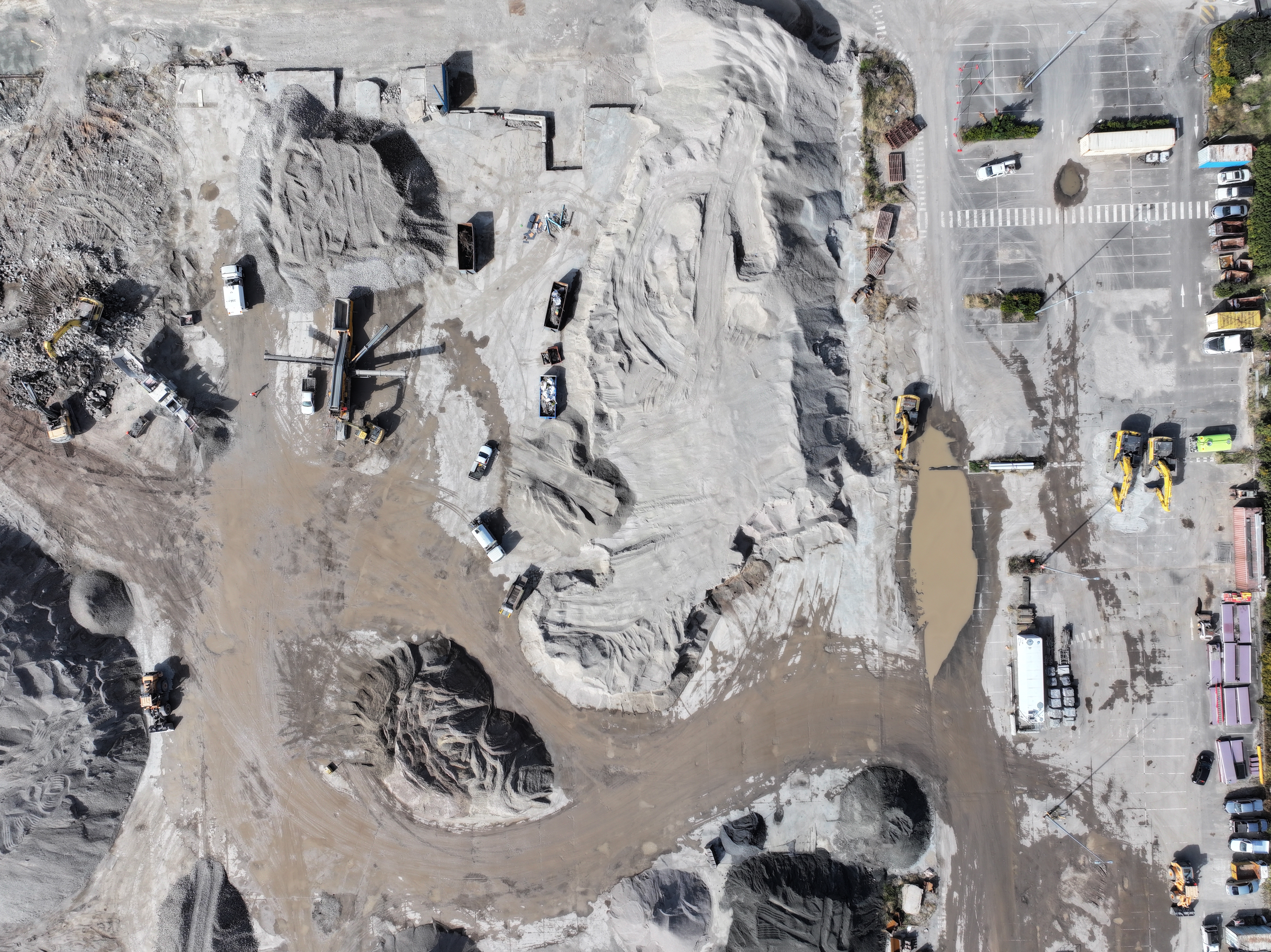
Before: The initial drone map reveals the construction site in its raw state—uneven terrain, unmarked boundaries, and unorganized material placement, making planning and coordination difficult. After: The updated drone map shows a well-organized site with leveled ground, clearly defined zones, and ongoing structures accurately positioned. These mapping insights helped streamline logistics, reduce delays, and improve overall site efficiency by over 60%.

Key Tools
The major tools that make these transformations possible
Flight Powered by DJI
Our drones use DJI technology for reliable, high-precision aerial mapping across all site conditions.

WaypointMap Configuration
A smart navigation overlay that turns drone missions into precision-guided journeys, one waypoint at a time.
Built on OpenDroneMap
All captured data is processed using WebODM, delivering fast, accurate 2D and 3D construction maps.