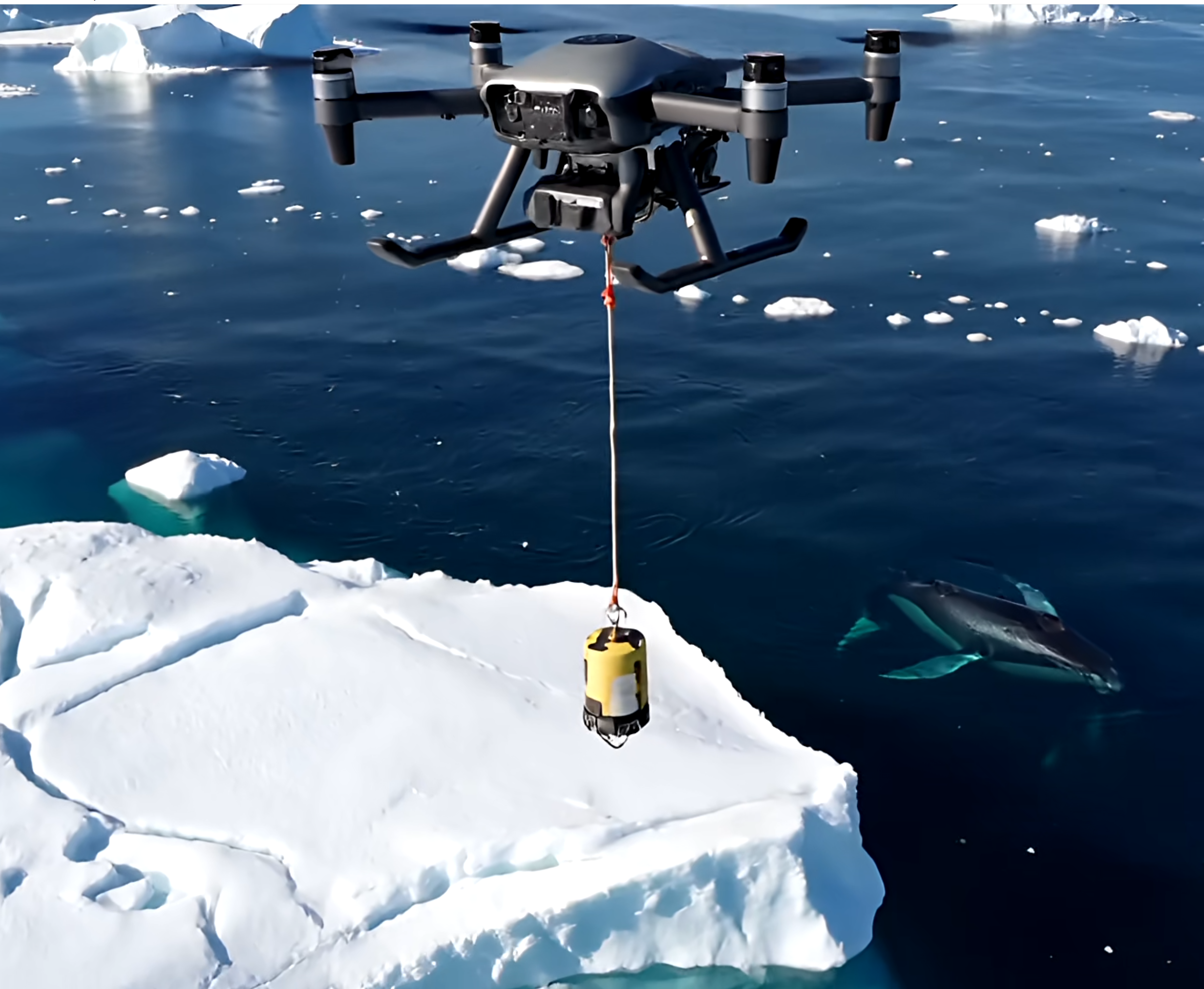
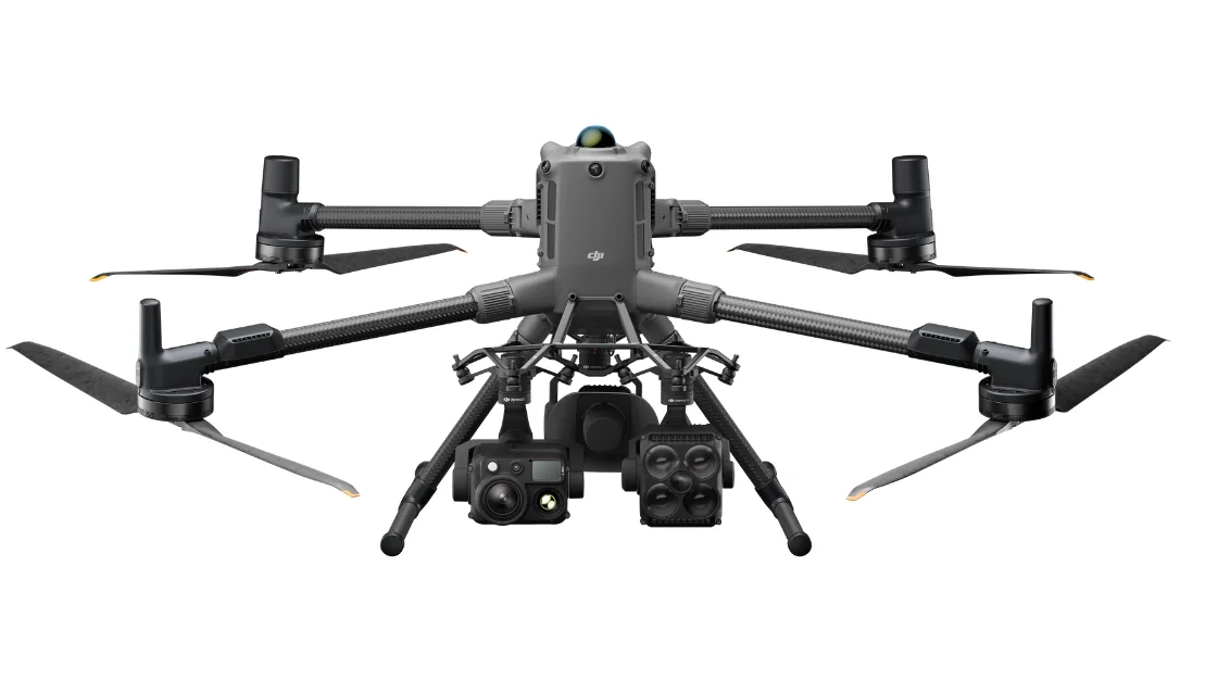
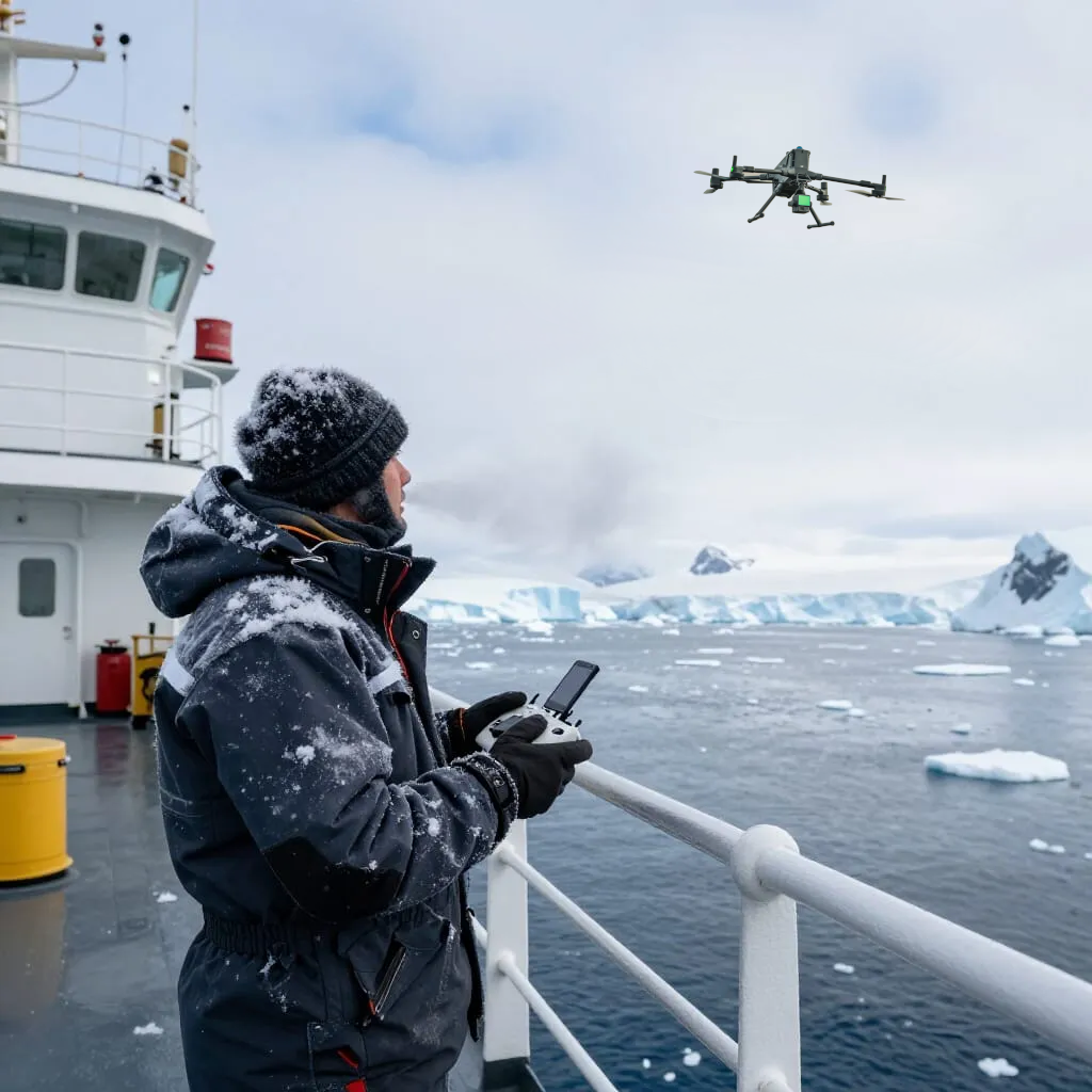
Polar Region Expedition-Grade Drone Operations

Drones are not just a tool for generating beautiful, high resolution video and photography.

Introducing the multi-role, expedition-grade drone workhorse delivering scientific-grade 3D and multispectral data, emergency response capability, and unmatched guest encounters.

Unlike smaller video drones, the extreme-weather rated aerial platform with superior distance, endurance and flight time is the definitive all-round solution for enhancing any polar expedition or high-latitude adventure.

CRUISE OPERATORS
Drone guest experience

Guest Experience & Commercial Value

  • Real time drone footage to bridge, expedition teams and onboard lounges and cabins
  • Post-flight content delivery
  • Edited highlight packages and educational storytelling
  • Brand differentiation competitors cannot offer
  • Drone deployment when helicopters cannot fly
  • Leading kayak, zodiac and shore teams to wildlife
  • An exclusive collaboration between drone videographers and the ship’s photographer, combining aerial and onboard perspectives to craft a standout cruise video
  • Onboard processing of video, photgraphy and photogrammetry data, no Internet required
  • Supervised introduction to drones and hands-on mini-drone flights as an extra unique activity option for guests with approval
Ship inspection drone

Ship Inspection & Navigation

  • Monitoring ice movement at height
  • Floating ice state ahead – live viewing
  • Pack ice navigation
  • AIS-aware situational awareness
  • Real-time wind and weather sensing
  • 4K optical zoom inspection
  • RTK positioning (cm-level accuracy)
  • Dynamic home point tracking ship movement
  • Ship-relative navigation near cranes & helidecks
  • Hull, propeller and superstructure inspection
  • Maintenance assessment without dry-docking
SCIENTISTS AND RESEARCHERS
Scientific mapping

Scientific Data & Mapping

  • Survey-grade sensors
  • Iceberg photogrammetry for detailed 3D models (Sketchfab example)
  • Multispectral imaging for plants, animals, ice
  • LiDAR point-cloud accuracy metrics
  • Repeatable mission planning
  • Identical time-series flight paths
  • Full metadata, EXIF, geotagging
  • Local NAS / ruggedised server workflows
Wildlife monitoring

Environmental & Wildlife Research

  • Whale and marine mammal monitoring
  • Bird and penguin colony observation for numbers using video and time lapse photography
  • Safe altitude wildlife operations
  • NDVI / NDRE vegetation mapping
  • Snow cover and melt pattern analysis
  • Relative ice reconnaissance and thickness inference
  • Suspended sonobuoy deployment and retrieval for whale-song research
  • Glacial and iceberg time-lapse studies
Ice hazard inspection

Hazardous Terrain & Ice Monitoring

  • Crevasse inspection via aerial video
  • Remote assessment of glacial cracks
  • Ice field, floe and iceberg reconnaissance
  • Live video support for zodiac and kayak teams
SAFETY MEASURES
Zodiac with landing pad Drone redundancy

Redundancy & Reliability

  • Pre-shore visits inspection capability
  • Compass and GNSS navigation
  • Auto Return-to-Home on signal loss
  • Precision landing on moving vessels
  • Obstacle sensing (forward / up / down)
  • Cold-weather self-heating batteries with health monitoring
  • High-intensity anti-collision strobes
  • Floats fitted for crash retrieval if required
Emergency SAR

Emergency & SAR

  • Payload drops: radios, floatation, survival kits
  • Thermal person-in-water detection
  • Temporary airborne VHF / UHF / LTE repeater
  • Night operations with thermal + low-light fusion
  • No rotor-wash risk near wildlife or ice
  • Rapid launch within minutes
  • Operates in conditions grounding helicopters
MANDATORY REQUIREMENTS and EQUIPMENT
Compliance documentation
  • AAD / IAATO compliant SOPs for commercial operations
  • ReOC / AROC / BVLOS certifications
  • Chief Remote Pilot flight log recording
  • Maintenance controller inspections
  • AVCRM commercial reporting
  • Ship-based risk assessments
  • Insurance-ready documentation
  • Incident and maintenance traceability
  • Audit-ready flight records
  • Environmental impact reporting
  • Drone flotation adaptations (water recovery)
  • GPS tracking and recovery if required
M400
  • DJI Matrice 400 enterprise aircraft
  • Up to 59 minutes flight time for extended missions
  • IP55 weather rating for all-weather operations
  • Operational temperature range from -20 °C to 50 °C
  • 360° obstacle sensing using LiDAR, radar, and vision sensors
  • O4 Enterprise transmission system with up to 40 km range
  • 6 kg payload capacity supporting multiple sensors simultaneously
  • Optimised for inspections, surveying, search and rescue, and expedition missions
  • Helicopter and zodiac transport compatible with a supplied, easily modifiable platform
  • Folded aircraft dimensions (with landing gear and gimbal): 490 × 490 × 480 mm (L × W × H)
BEYOND ANTARCTICA
Global expeditions
  • Luxury expedition storytelling worldwide
  • Tropical reef and coral mapping
  • Volcanic island surveys
  • Remote coastal inspections
  • River delta and mangrove monitoring
  • Disaster response cruises
ABOUT THE REMOTE PILOT
Professional profile

Paul Gonsior, now a Chief Remote Pilot and commercial drone operator, has had 23 years of naval electrical engineering service, delivering exceptional maritime awareness, operational discipline, and leadership in remote and high-risk environments. With a further 20 years of enterprise IT expertise, he brings strong systems and infrastructure capability to complex operations at sea. A licensed professional drone pilot operating under his own CASA-registered ReOC, Paul holds BVLOS and AROC certifications and combines advanced aerial operations with videography, photography, and web design. He has the ability to work seamlessly alongside scientific teams and professional videographers, adding technical, operational, and creative value while confidently providing onboard guest presentations. His role on board ship will complement guest experiences, science studies, IT, videographer and creative AV production operations alike.